Inchkeith sits in the Firth of Forth between Edinburgh and Pettycur and its believed to have been used by people for several hundred years. Its most recent use was during the World Wars when the island would act as a defence against any ships wishing to sail up the Firth of Forth. Most of the buildings that were left over from those days still remain on the island in various states of repair. It ceased to be a military installation in 1956/7 and was passed to the Northern Lighthouse Board. The island was then sold to Tom Farmer in 1986 who hasn't done much with it since then.
I had read somewhere that a ship failed to stop when coming up the Forth and a warning shot was fired across its bow, however the shot then hit one of the towns on the North side of the river destroying a few buildings. Oops!
We've had our eye on Inchkeith for quite some time and we finally managed to organise a trip out to the island before Winter properly set in.
Inchkeith is like nowhere we have explored before and is rarely visited by people other than those looking for a day out on their boats. We set out in the early morning to catch the high tide, making launching our preferred method of transport slightly easier, and off we went to the island.
Our first port of call was the harbour where we came ashore and moored the boat. We had a stunning day weather wise however the harbour did its job of sheltering us from the swell of the Forth.
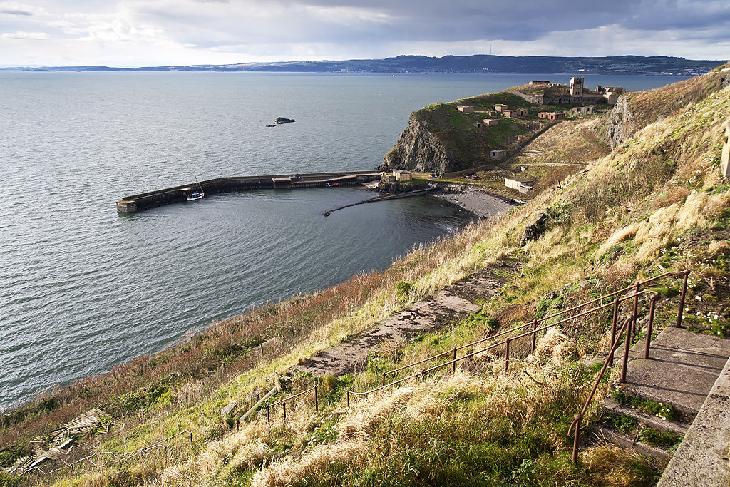
The harbour sits on the west side of the island looking towards the Forth Bridges and Edinburgh. Above it sits one of the many gun emplacements the island is littered with. With so much to explore we set out to the west fort which has numerous underground storage areas dug into the rock. The view from the top of the fort looking across the island was spectacular.

Here you can see the highest point of the island which is home to a still operational lighthouse.
At the top of the west fort is one of the large gun emplacements which looks up the river towards the Forth Bridges.
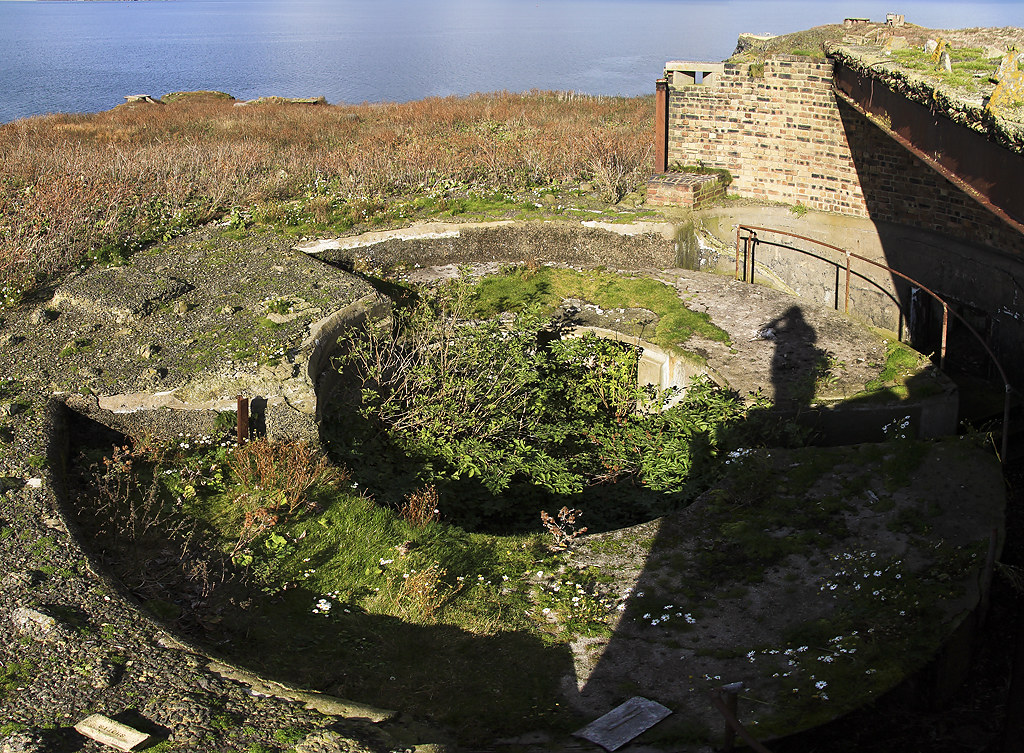
This one was soon to be eclipsed in size by what we found later.
From there we made our way to the centre of the island and the lighthouse we had glimpsed from the west fort. As you reach the top of the hill you are met with a number of old houses which, given how long they have been there, are still in reasonable condition.
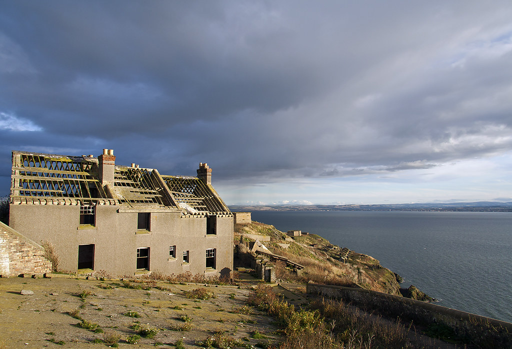
The wooden roof frames are still intact along with the sash windows, minus the glass though. Inside the buildings still retain their wood finishings and this tiled fireplace.
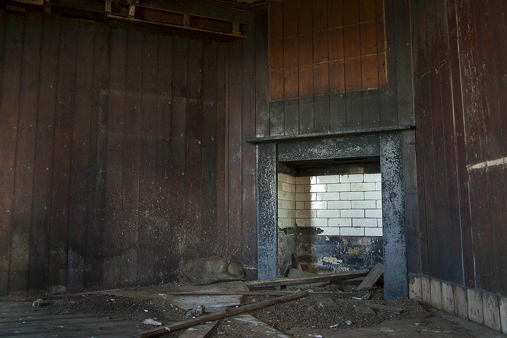
We made our way further up the hill to the lighthouse.
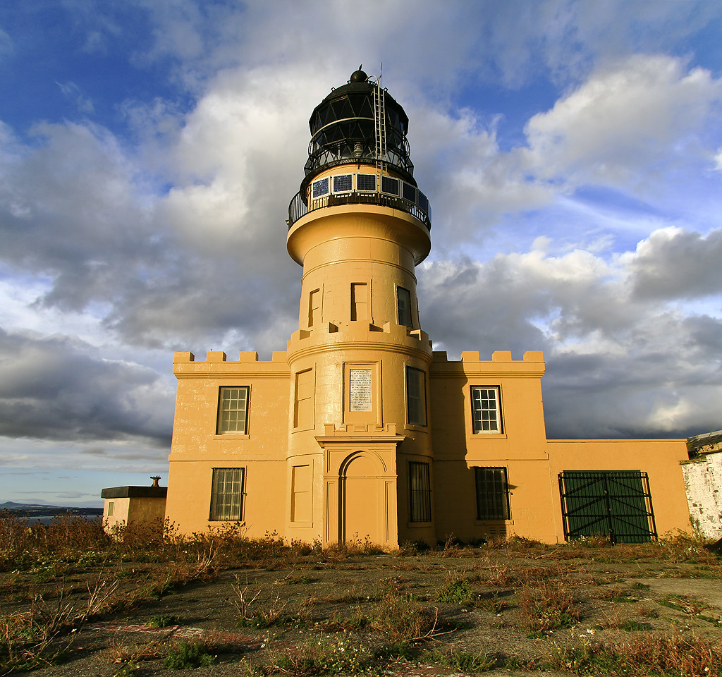
The lighthouse is no longer manned however is inspected regularly and is in full working order. The inscription on the front of the building reads:
<em>"For the direction of mariners, and for the benefit of commerce, this lighthouse was erected by order of the commissioners of the nothern lighthouses.
It was founded on the 18th day of May in the year of 1803, and lighted on the 14th of September 1804.
Thomas Smith, Engineer"</em>
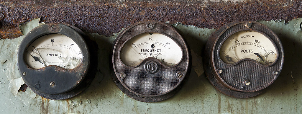
The area directly in front of the lighthouse is a former helicopter pad with a few service buildings adjacent to them. We were surprised to find that some equipment was left over and hadn't been recycled yet.
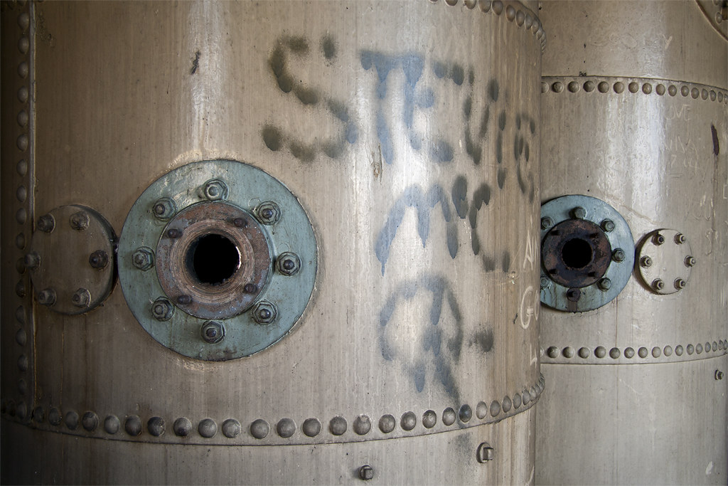
There were also a few large boilers or tanks next to these however our knowledge of industrial machinery, or lack thereof, meant we couldn't identify their former use.
From there we scaled one of the other buildings at the highest point and were greeted with a spectacular view of the Firth of Forth looking out towards the North Sea.

There were a few large container ships anchored here and if you look closely enough you should be able to make out the Bass Rock on the horizon.
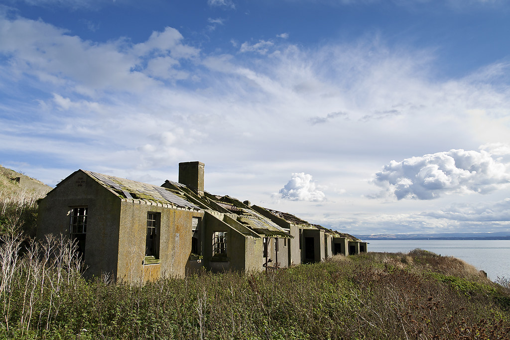
We then made our way towards the south part of the island negotiating a very overgrown cliff top path which hasn't seen visitors in years. Before reaching the next gun emplacements we found more housing, although these did not fair as well as the previous ones. Nature has made a hardy attempt at reclaiming these buildings with small trees growing inside a few of them.
We pressed on from there and finally reached the south gun emplacement. Again there were various storage areas cut into the rock of the island which we assumed were for the ammunition of the large guns.
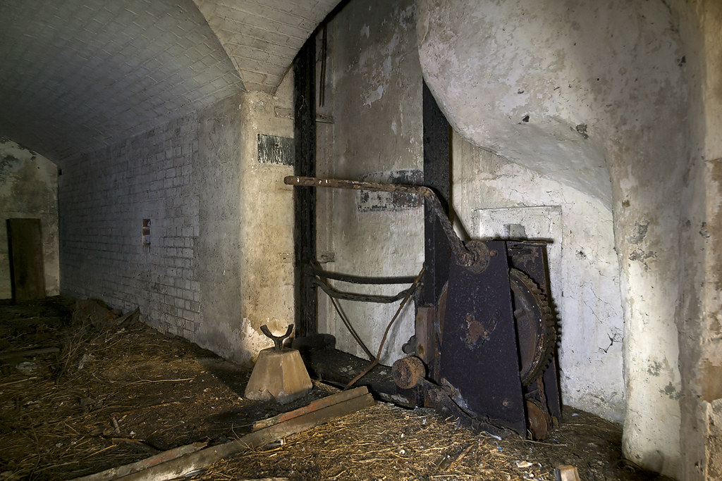
We presumed this hoist was used to transport the massive shells from the storage area to the gun situated directly above.
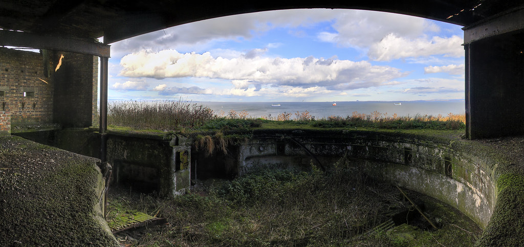
The gun emplacement itself has a spectacular view of the Firth of Forth and must have been massive when it still stood. To give you an idea of perspective when you stood in the centre of this "ground level" would have been at shoulder/head height.
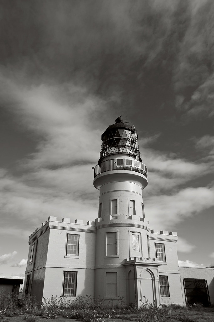
A final shot of the lighthouse of the island.
I know I don't post reports too often so thought I'd better put this up since you don't generally see too much of it.
I had read somewhere that a ship failed to stop when coming up the Forth and a warning shot was fired across its bow, however the shot then hit one of the towns on the North side of the river destroying a few buildings. Oops!
We've had our eye on Inchkeith for quite some time and we finally managed to organise a trip out to the island before Winter properly set in.
Inchkeith is like nowhere we have explored before and is rarely visited by people other than those looking for a day out on their boats. We set out in the early morning to catch the high tide, making launching our preferred method of transport slightly easier, and off we went to the island.
Our first port of call was the harbour where we came ashore and moored the boat. We had a stunning day weather wise however the harbour did its job of sheltering us from the swell of the Forth.

The harbour sits on the west side of the island looking towards the Forth Bridges and Edinburgh. Above it sits one of the many gun emplacements the island is littered with. With so much to explore we set out to the west fort which has numerous underground storage areas dug into the rock. The view from the top of the fort looking across the island was spectacular.

Here you can see the highest point of the island which is home to a still operational lighthouse.
At the top of the west fort is one of the large gun emplacements which looks up the river towards the Forth Bridges.

This one was soon to be eclipsed in size by what we found later.
From there we made our way to the centre of the island and the lighthouse we had glimpsed from the west fort. As you reach the top of the hill you are met with a number of old houses which, given how long they have been there, are still in reasonable condition.

The wooden roof frames are still intact along with the sash windows, minus the glass though. Inside the buildings still retain their wood finishings and this tiled fireplace.

We made our way further up the hill to the lighthouse.

The lighthouse is no longer manned however is inspected regularly and is in full working order. The inscription on the front of the building reads:
<em>"For the direction of mariners, and for the benefit of commerce, this lighthouse was erected by order of the commissioners of the nothern lighthouses.
It was founded on the 18th day of May in the year of 1803, and lighted on the 14th of September 1804.
Thomas Smith, Engineer"</em>
The area directly in front of the lighthouse is a former helicopter pad with a few service buildings adjacent to them. We were surprised to find that some equipment was left over and hadn't been recycled yet.

There were also a few large boilers or tanks next to these however our knowledge of industrial machinery, or lack thereof, meant we couldn't identify their former use.

From there we scaled one of the other buildings at the highest point and were greeted with a spectacular view of the Firth of Forth looking out towards the North Sea.

There were a few large container ships anchored here and if you look closely enough you should be able to make out the Bass Rock on the horizon.
We then made our way towards the south part of the island negotiating a very overgrown cliff top path which hasn't seen visitors in years. Before reaching the next gun emplacements we found more housing, although these did not fair as well as the previous ones. Nature has made a hardy attempt at reclaiming these buildings with small trees growing inside a few of them.

We pressed on from there and finally reached the south gun emplacement. Again there were various storage areas cut into the rock of the island which we assumed were for the ammunition of the large guns.

We presumed this hoist was used to transport the massive shells from the storage area to the gun situated directly above.
The gun emplacement itself has a spectacular view of the Firth of Forth and must have been massive when it still stood. To give you an idea of perspective when you stood in the centre of this "ground level" would have been at shoulder/head height.

A final shot of the lighthouse of the island.

I know I don't post reports too often so thought I'd better put this up since you don't generally see too much of it.


