boxfrenzy
Well-known member
- Joined
- Apr 16, 2008
- Messages
- 86
- Reaction score
- 36
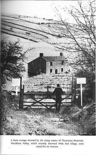
During a visit to the library with my kids last Spring, I was flicking through a book when I found a brilliant picture. It showed a partially submerged house, as the rising waters of a new reservoir flooded a valley. I looked for the book a fair few times afterwards, but was unable to find it. I was disappointed not to have remembered where it was, as it looked great.
Last weekend, I headed north of Otley, Yorkshire, to check out a place which looked reasonable on Google Maps; various ruined buildings, fairly close together. Further investigation revealed this was the remains of the abandoned village of West End.
I'm not sure what this building was. Chapel, house, or just a barn? It was on the side of what had once been a road.
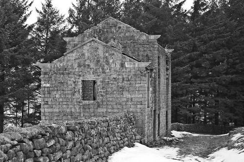
Little remained except the walls. Part of the roof was missing and animals obviously sheltered from the biting Yorkshire winds here. The stone step looked very worn.
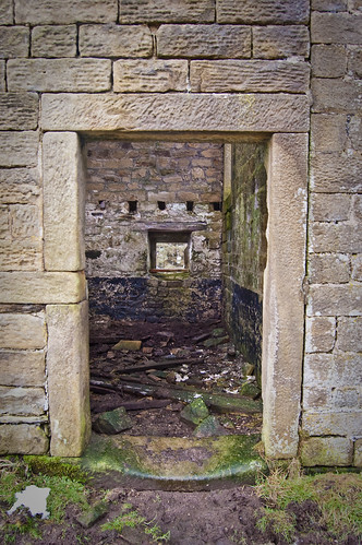
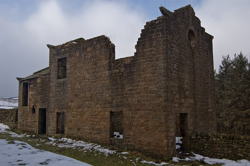
I did like the circular windows, high up at the end of each part of the building.
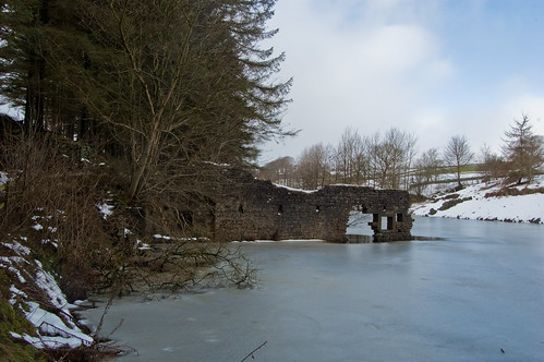
I followed the track down to Thruscross reservoir, a couple of minutes from here. Beneath the ice was the remains of West End village, abandoned in the mid 1960's and flooded to provide water for the growing population of Leeds.
This was West End Mill, a flax mill that was once thriving in the late 1800's and early years of the twentieth century.
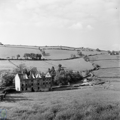
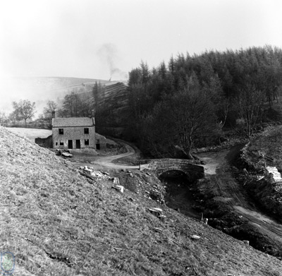
This is the mill before the village was flooded. The river Washburn flows past, and under a single track bridge.
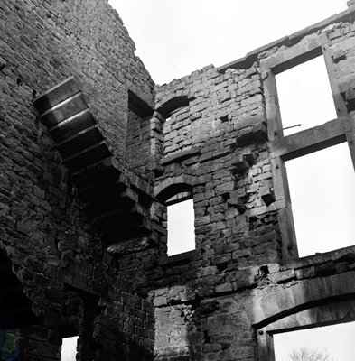
Much of the village was cleared before the dam was built. Here is another picture I didn't take inside the mill.
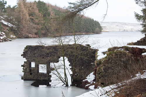
Today, the water level is where it normally is. A couple of times, in the 1960's and the 1990's the water level has gone down enough to see the foundations of the houses and church. Much of the buildings were demolished, except this wall of the mill.
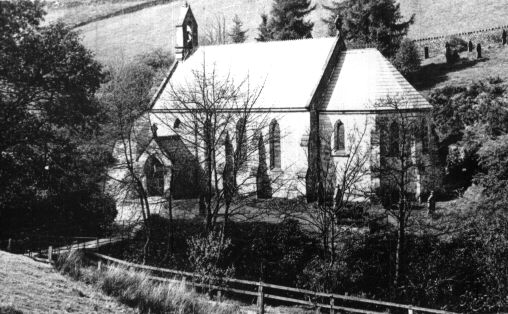
The flooding of the village meant houses, a school, the mill, th church and the graveyard became submerged. The graves were exhumed and reburied. Here is the church of West End.
Apparently, under the water, the old West End bridge remains. I like that fact.
Here it is readers. The smoke in the background is from the clearance of the area before flooding.
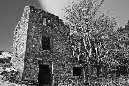
On the banks of Thruscross reservoir are the ruins of another house, called Holme Field Head.
The ground floor of the house is interesting. It looks like it was not for people - animals or storage. There were three arched rooms.
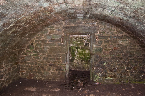
The end room.
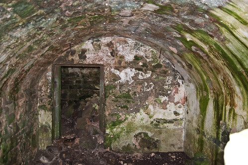
They were connected by a dark stone corridor, and a collapsed spiral staircase up into the house. Magnifying glass users may just be able to see the remains of the stairs on the left of the pile of stone at the end of the corridor.
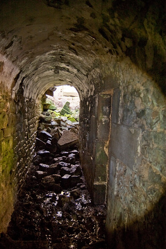
The stone floor remained, although the other floors and roof had long disappeared. Beneath here were the arched rooms.
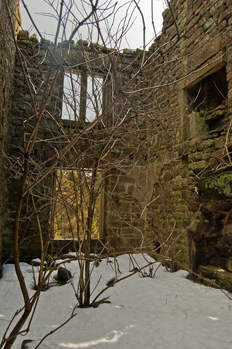
Holme Field head. I could hear the sound of water very close to the right of the house. Because of the snow cover, sadly I was unable to see whether there was a well.
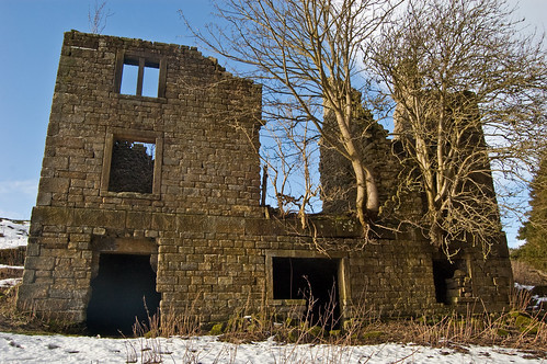
A last view of Holme Field Head and outbuilding, looking down into the valley where the village of West End once was.
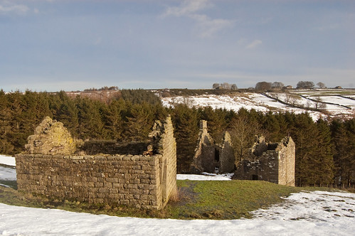
Knowing what the village was called meant that I was able to go back to the library and find the book that I had been looking at, last spring. This is the picture, horrifically scanned, that I really liked.
Last weekend, I headed north of Otley, Yorkshire, to check out a place which looked reasonable on Google Maps; various ruined buildings, fairly close together. Further investigation revealed this was the remains of the abandoned village of West End.
I'm not sure what this building was. Chapel, house, or just a barn? It was on the side of what had once been a road.

Little remained except the walls. Part of the roof was missing and animals obviously sheltered from the biting Yorkshire winds here. The stone step looked very worn.

I did like the circular windows, high up at the end of each part of the building.

I followed the track down to Thruscross reservoir, a couple of minutes from here. Beneath the ice was the remains of West End village, abandoned in the mid 1960's and flooded to provide water for the growing population of Leeds.
This was West End Mill, a flax mill that was once thriving in the late 1800's and early years of the twentieth century.

This is the mill before the village was flooded. The river Washburn flows past, and under a single track bridge.

Much of the village was cleared before the dam was built. Here is another picture I didn't take inside the mill.

Today, the water level is where it normally is. A couple of times, in the 1960's and the 1990's the water level has gone down enough to see the foundations of the houses and church. Much of the buildings were demolished, except this wall of the mill.

The flooding of the village meant houses, a school, the mill, th church and the graveyard became submerged. The graves were exhumed and reburied. Here is the church of West End.

Apparently, under the water, the old West End bridge remains. I like that fact.
Here it is readers. The smoke in the background is from the clearance of the area before flooding.

On the banks of Thruscross reservoir are the ruins of another house, called Holme Field Head.

The ground floor of the house is interesting. It looks like it was not for people - animals or storage. There were three arched rooms.

The end room.

They were connected by a dark stone corridor, and a collapsed spiral staircase up into the house. Magnifying glass users may just be able to see the remains of the stairs on the left of the pile of stone at the end of the corridor.

The stone floor remained, although the other floors and roof had long disappeared. Beneath here were the arched rooms.

Holme Field head. I could hear the sound of water very close to the right of the house. Because of the snow cover, sadly I was unable to see whether there was a well.

A last view of Holme Field Head and outbuilding, looking down into the valley where the village of West End once was.

Knowing what the village was called meant that I was able to go back to the library and find the book that I had been looking at, last spring. This is the picture, horrifically scanned, that I really liked.


