Geordie_Jon
Member
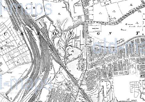
Visited the remains of a huge complex on the north edge of Stockton with MissFish and Mykal as a followup to the discussion in http://www.derelictplaces.co.uk/main/showthread.php?t=4733 My earlier assumption that it was part of the North East Railway was only partly correct - the railway owned the engine shed to the far north-west of the site.
The site seems to date back to Victorian times or maybe earlier, initially as a 'steam engine manufactory' according to a map from 1860. Later maps show it as being a locomotive works. I am pretty sure this is Blair's Engine Works, a facility which built marine engines and locomotives, but have been unable to confirm it. If you look at the remains of the massive iron columns in my photo you'll see they match up with those in the 1901 interior shot of the works and maybe that is evidence enough. According to Stockton Council's site the works closed in 1933. A North East Railway, latterly the LNER, depot was to the far west of the site but has all but vanished.
Copyright on these images belong to old-maps.co.uk and Stockton Council. Hopefully they won't mind them being used in this context, but if they do then I'll remove them.
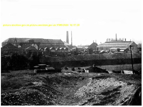
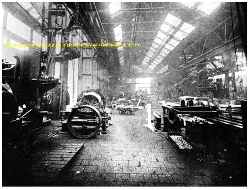
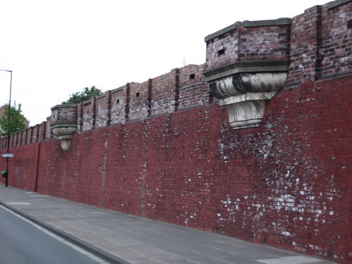
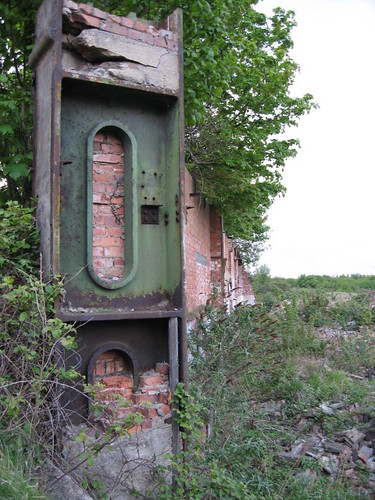
Apologies for the quality of this shot but I was standing in the middle of an A-road at the time. The ornate 'balconies' may have been decoration only. The wall has a number of bricked up entrances.
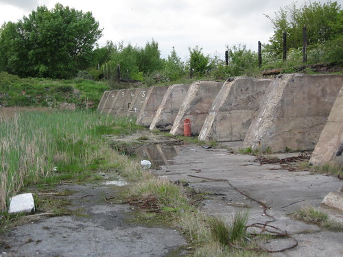
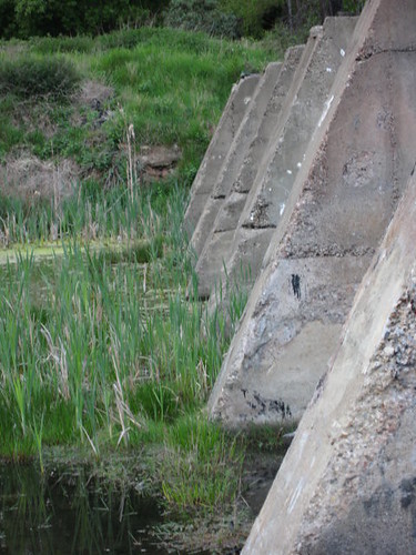
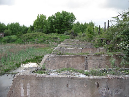
There once was a coal depot here and these are the coal drops. The concrete piers carried the rail track over a series of bays where it either went direct in to vehicles or was bunkered for future use.
These massive columns are visible in one of the contemporary shots above.
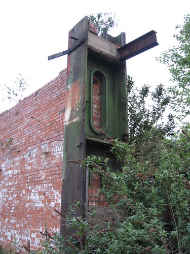
Foundation for some large piece of machinery.
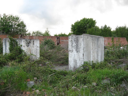
'The Hole' - a vast sunken area where a reinforced concrete structure once stood. It would easily hold four football fields, now all reduced to rubble.
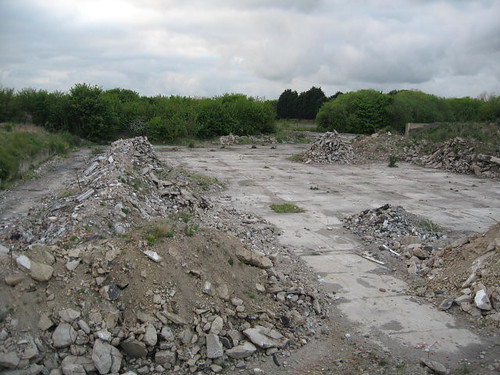
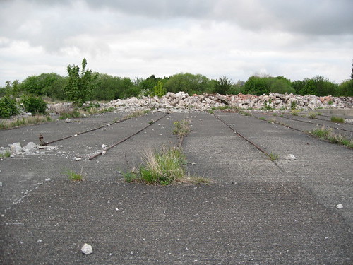
One of the few clues to what this place once was: a piece of light gauge rail, embedded in tarmac.
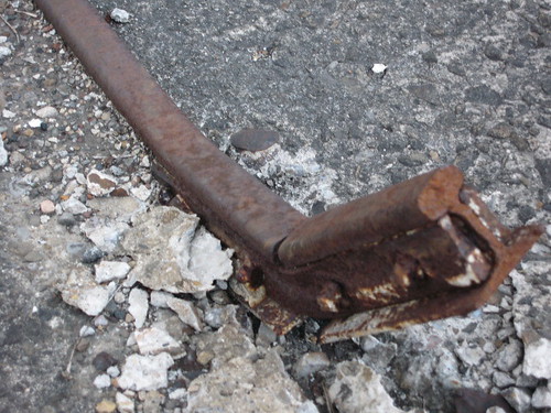
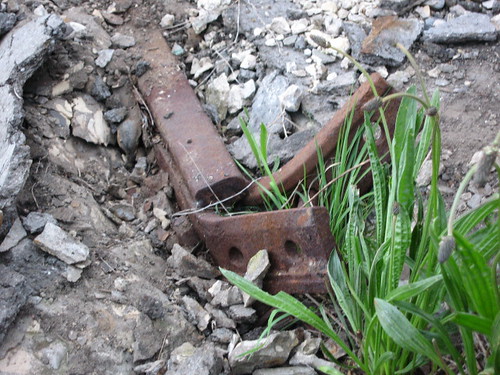
Standard gauge rail a few yards away:
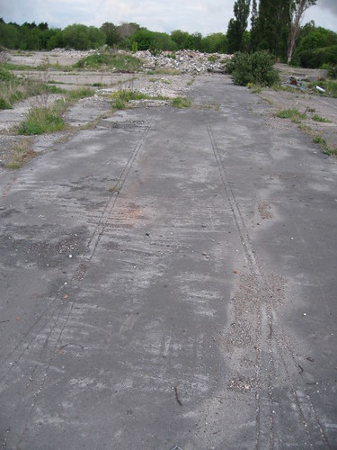
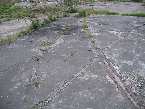
The odd looking lines are buried rail track under more recent tarmac.
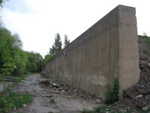
One of the few structures still standing was this retaining wall. Height is in excess of 15'.
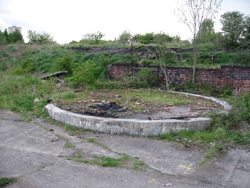
The base pad for a large tank. The lack of a containment bund suggests it might have been a water tank.
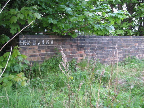
A stream runs through the site. This wall is part of the tunnel which carries it. Access to the portal looks tricky.
This is probably one of the most comprehensively trashed sites I've been to, but the scale of it is simply staggering. It must have been very impressive when it was standing.
A word of warning to anyone who fancies a look: the scrapyard adjacent to the site, formerly the coal depot, has seen the attentions of the scrapman or pikies in the past few weeks. All the accessible metal has gone and the building roof is very unstable after the visitors took out the steel beams with a gas torch. Next time we get big wind I think the roof will be down.
The other word of warning is that this is in the district of Stockton called Tilery: it is a pretty rough neighbourhood, more so at night.
The site seems to date back to Victorian times or maybe earlier, initially as a 'steam engine manufactory' according to a map from 1860. Later maps show it as being a locomotive works. I am pretty sure this is Blair's Engine Works, a facility which built marine engines and locomotives, but have been unable to confirm it. If you look at the remains of the massive iron columns in my photo you'll see they match up with those in the 1901 interior shot of the works and maybe that is evidence enough. According to Stockton Council's site the works closed in 1933. A North East Railway, latterly the LNER, depot was to the far west of the site but has all but vanished.
Copyright on these images belong to old-maps.co.uk and Stockton Council. Hopefully they won't mind them being used in this context, but if they do then I'll remove them.


Apologies for the quality of this shot but I was standing in the middle of an A-road at the time. The ornate 'balconies' may have been decoration only. The wall has a number of bricked up entrances.

There once was a coal depot here and these are the coal drops. The concrete piers carried the rail track over a series of bays where it either went direct in to vehicles or was bunkered for future use.


These massive columns are visible in one of the contemporary shots above.


Foundation for some large piece of machinery.

'The Hole' - a vast sunken area where a reinforced concrete structure once stood. It would easily hold four football fields, now all reduced to rubble.

One of the few clues to what this place once was: a piece of light gauge rail, embedded in tarmac.


Standard gauge rail a few yards away:

The odd looking lines are buried rail track under more recent tarmac.


One of the few structures still standing was this retaining wall. Height is in excess of 15'.

The base pad for a large tank. The lack of a containment bund suggests it might have been a water tank.

A stream runs through the site. This wall is part of the tunnel which carries it. Access to the portal looks tricky.

This is probably one of the most comprehensively trashed sites I've been to, but the scale of it is simply staggering. It must have been very impressive when it was standing.
A word of warning to anyone who fancies a look: the scrapyard adjacent to the site, formerly the coal depot, has seen the attentions of the scrapman or pikies in the past few weeks. All the accessible metal has gone and the building roof is very unstable after the visitors took out the steel beams with a gas torch. Next time we get big wind I think the roof will be down.
The other word of warning is that this is in the district of Stockton called Tilery: it is a pretty rough neighbourhood, more so at night.
Last edited:


